|
Winter Fun in the Sun Quartzsite, Arizona January 2001 Page 2 |
Sunday
I t felt good to get to sleep late on this morning. We had planned to move on to Quartzsite today, but with the distance to our destination only a little over 30 miles away; we were able to get up late. Even so, when I stepped out of our motorhome, I saw nobody else out and around. So, I walked around to get a few photos of the campground we had seen only in the dark the day before. I found that our motorhome was parked under a mesquite tree.
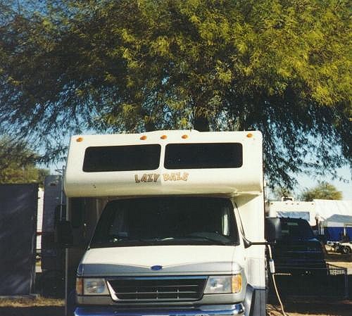 Our place under a mesquite tree |
The campground is located on the west bank of the Colorado River. I walked down to a little wooden deck that overlooked the river where I took a picture looking up river to the left and down river to the right. From there I looked back up the road to a reddish colored dirt cliff at the far end of the campground road.
|
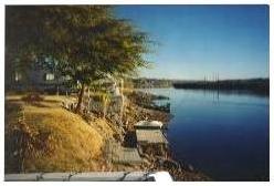
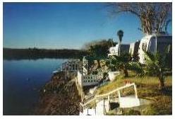
 Our camping area as viewed from the river side of campground |
I walked up to the campground office to see about checking in. It was about 9:45, but the office was not yet open. Next to the office was a room set up for a breakfast for a large group of people. The aroma of breakfast meats cooking came through the door. It really smelled good. Unfortunately, a sign on the door advertising "A Champaign Breakfast" for only $5 said that the breakfast was "SOLD OUT."
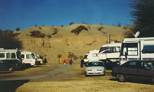
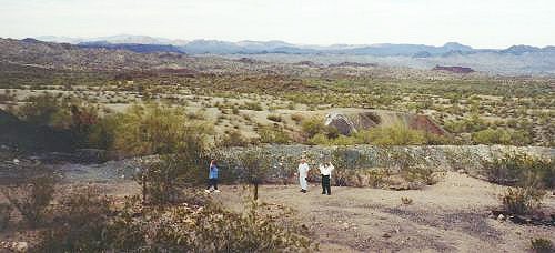
As I walked back toward our motorhome I saw Barbara and Miriam on their morning walk around the campground. When I arrived at our motorhome, Tom was out and he said he was ready to stay another day. It sounded like a good idea to me. It would give us an opportunity to look around the area near Parker.
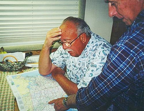
With us staying in the area for another day, we would have time for a nice breakfast. Kay fixed an old fashioned bacon and egg breakfast for us. After our morning meal, I stepped outside again and found Tom, and Nora with Dave looking at a map to find some place of interest for us to visit for the day. Tom wanted to show us the Poston memorial to a group of people of Japanese ancestry who were interned in a relocation camp during World War Two (WWII.)
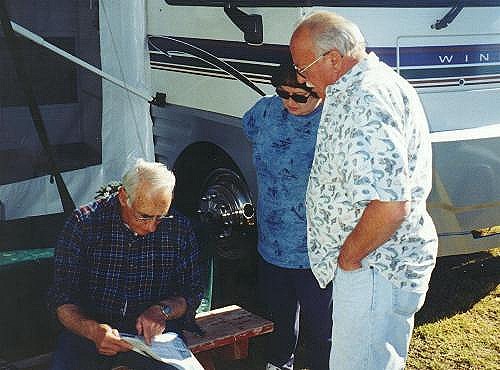 Looking for a place to visit during our stay |
It didn’t take us long to reach the Poston memorial site as it is just south of Parker. The memorial was built to not only pay tribute to those people who suffered in the camps, but to honor the Americans of Japanese ancestry from the camp who lost there lives in combat during the war. A plaque was also put in place to honor to the cooperation of the people of the Colorado River Indian Tribes.
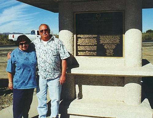 Tom and Nora next to the centerpiece of the Poston memorial |
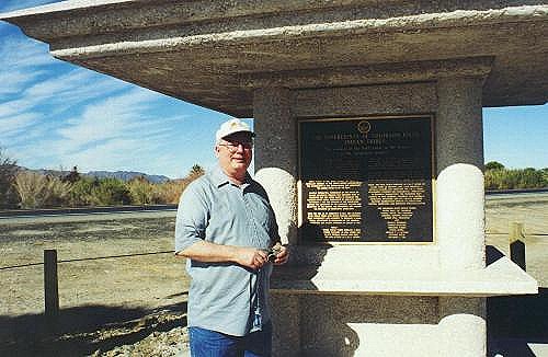 My chance to show that I was here |
This memorial gave me several photo opportunities. The design was simple but beautiful with a very tall structure in the center. I’m not sure what the structure symbolizes, but it looks as if it might be Japanese in nature. (I learned later that the tall column was designed by the architect so that the viewer could decide in their own mind what the structure means)
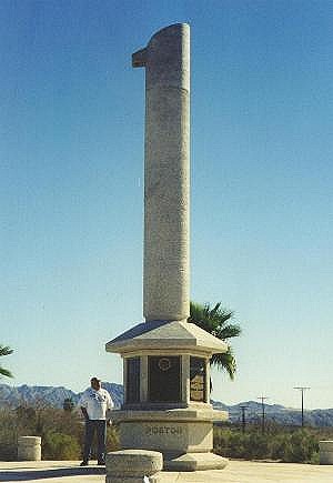 This interesting structure dominates the Poston memorial |
When we left Poston we would try to find our way to a ghost town our in the desert to the east of Parker. We would be using a crude map to find our way. The map was a Quartzsite map that included the ghost town as a side trip from Quartzsite. We left the highway at a place called Bouse, Arizona, which is about 25 miles south of Parker. This small town was near the location used by the U.S. Army in WWII to train tank crews in desert warfare at Camp Bouse.
Shortly after turning off the highway we crossed a railroad track and drove away from Bouse. On the right side of the road we saw a small museum. Parked outside were a couple of old Army trucks from WWII that reminded me of our friend Dick who likes to restore such vehicles.
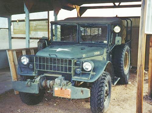 A type of truck that was common at Camp Bouse |
After stopping to take pictures of the trucks, we continued on into the desert. Because we would be driving out into an area with primitive roads, I brought my GPS receiver. It didn’t take long to discover that the map we were using was about as primitive as the roads we would be using. However, the nature of the roads added to the sense of adventure.
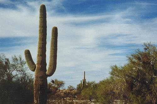 Saguaro cactus is very common in this area |
We quickly came across saguaro cacti of various ages and conditions. Many of the cacti we saw were in bad condition and looked as if they would not survive much longer. One cactus plant appeared to have more holes in it than healthy tissue. There was a very distinctive cactus with several arms growing in all directions. We had to stop to get a good picture of the unusual plant.
 An unusual cactus near the road |
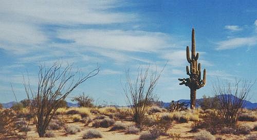
At times we were driving through areas covered with a large number of a small type of cactus. I don’t know what it was, but it was very common throughout the desert landscape. We would see this small cactus many times has we headed for the ghost town in the desert.
The roads we traveled were mostly dirt, gravel and sand covered. I saw a sign ahead of us that had a feminine appearance. Tom referred to the sign as a "Road corset." It turned out to be a sign for a narrow bridge ahead. We crossed several small, narrow bridges during the day. A couple of the bridges we crossed were over a canal that really looked out of place in the middle of the hard desert.
 It looks as if we are coming to a road corset |
With the aid of a couple of partial maps, a few road signs, and a GPS receiver, we found our way to the ghost town with only two minor wrong turns. The GPS receiver makes it very easy to see when we were headed in the wrong direction. That means that it only takes a short time to turn around and get back on track. Without a GPS receiver, we could have driven several miles before finding we needed to turn around. As it was, we never drove more than a quarter of a mile in the wrong direction.
As we drove along the Swansea Road another car was coming toward us. Tom slowed down and asked the driver of the other vehicle how far we had to go. The driver said the ghost town was just around the next bend. As we continued on, the car reached a high point on the road and headed down the descending slope toward a bend in the road. Just as we rounded the bend the ruins of the town of Swansea were visible ahead. We had traveled roughly 25 miles from Bouse.
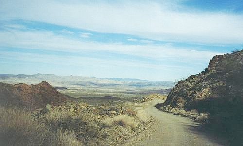 Swansea is just around the bend in the road |
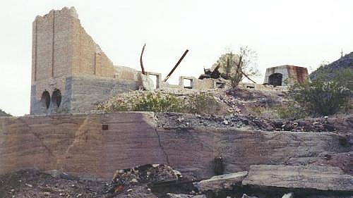
To call Swansea a ghost town is a bit of a stretch. There isn’t much left other than foundations and collapsed walls. The town was the location of a copper mining area with a smelter operation. There is a row of concrete buildings that are nothing more than boxes with a couple of doorways. Originally the structures were living quarters for workers.
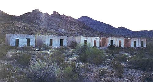 The only structures in town that are still mostly complete |
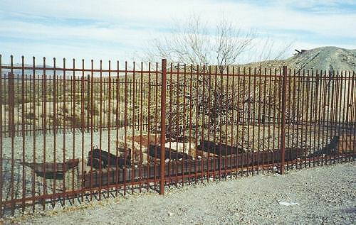 A wrought iron fence around a big hole in the ground |
Tom pulled the car up near a wrought iron fence. It turns out that the fence is around the opening to an open mineshaft. I just had to do what it appears hundreds of others had done; I threw a couple of rocks into the shaft. There are several wooden beams across the shaft, deep inside, that kept the rocks from getting very far. The beams were covered with hundreds of rocks that other visitors had tossed into the shaft.
 Many people have thrown rocks down this mine shaft |
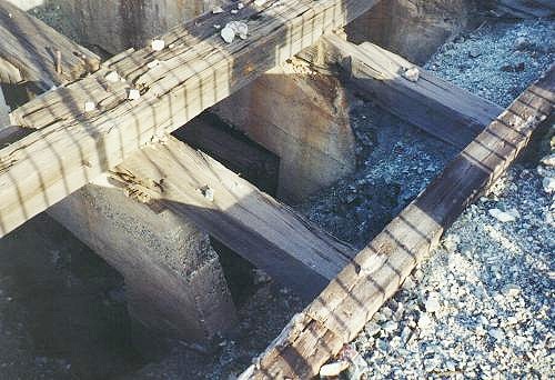
There is a trail around the ruins with signs placed along the way that tell the story of what can be seen near each sign. The biggest structure is the collapsed walls of a smelter. There also is a ruin of a refractory. As we walked around the twisted steel and piles of bricks, we all were snapping pictures.
 Ruins of a dust smelter |
At one point along the trail a sign pointed out a large slag flow. It looks as if the slag from the smelters was just dumped out on the ground. This created a large area that looked very much like a volcanic lava flow. A cut through a section of the slag revealed that the deposit is several feet deep.
 This is how greater downtown Swansea looks today |
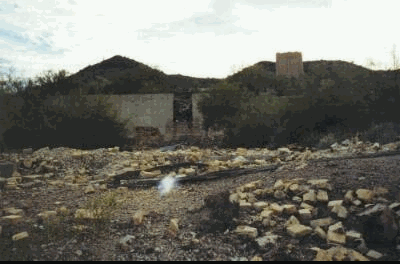 All that is left of a refractory |
We explored the Swansea ruins for about an hour. Then it was time for us to try to find our way back to civilization. Tom had talked to a man earlier that told him there was a shorter way to get to town than the way we came into the area. So, as we drove along Swansea Road it was decided we would turn right at the next intersection. This would be opposite to the direction we came from when we were headed toward Swansea.
This is where we made a minor wrong turn due to the fact we were using a map that was inaccurate. The breadcrumb trail on the GPS receiver showed we were heading the wrong direction. Once turned around and driving the correct direction, the GPS breadcrumb trail illustrated clearly that the map we used was very wrong. It wasn’t very long until we found we were on "Powerline Road" and it was clear where the road got its name.
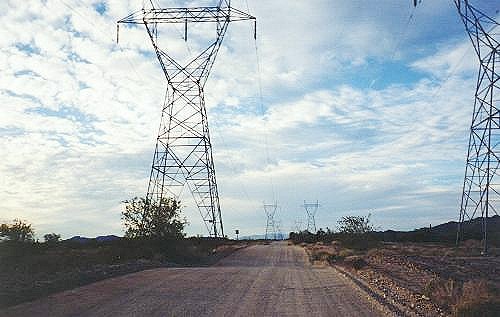 Powerline Road — A road well named |
Marching across the desert are two rows of high power towers that support two sets of high-tension lines. Right down the middle of the towers runs Powerline Road with high-tension lines on both sides. In a while we left the power lines behind and before we knew it we found a paved road. This road would take us right into the town of Parker. The total distance on this return path was about half the distance we traveled to get to Swansea. Our return to Parker covered just less than 28 miles.
We arrived in town just after the sun set over California. The sky was still light as we found our way back to the campground. We arrived at our motorhome just in time for dinner. After our evening meal we all gathered in Tom and Nora’s motorhome.
 Planning a future trip |
 A nice time to visit |
Tom and Dave were looking over a map of the United States as they planned a trip they would be taking together later in the year. We all visited for a while, with Gary telling us about his visit to Quartzsite. He told us of a line of motorhomes four miles long waiting to get into town. With that Gary told us of a way to get around the traffic jam if we were to come across one when we went to Quartzsite. We ended our visit by celebrating a special occasion as Nora served up cake and ice cream. It was a fun way to end a fun day.
[BEGIN]![]() [SUMMARY]
[SUMMARY]![]() [RV
FUN TRIPS HOME]
[RV
FUN TRIPS HOME]
If you have comments or suggestions, please contact the .
Copyright 2001 - 2007, RVFunTrips.com. All rights reserved.